

Aras UNESCO Global Geopark is situated in the northwest of Iran. The Aras River forms the northern boundary of the geopark, serving as the dividing line between Iran, Armenia, and Azerbaijan. Within the geopark's region, there are three designated protected areas. The area's conservation efforts are significantly influenced by its rich wildlife variety and the existence of endangered species like the Caucasian Black Grouse, Red Deer, Armenian Ram, and Leopard.
Celebrating Earth heritage
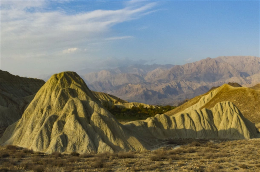
Within Aras Geopark, four lithological provinces can be identified. The western cliffs and highlands consist of Late Paleozoic and Early Mesozoic carbonate rocks. In the central areas of the Geopark, there are Cretaceous and Eocene sandstone, shale, and marl beds with a prevalent flysch facies. Towards the east, intrusive igneous rocks, primarily granitic in nature, dominate the region. In the southern and central parts of the area, there are dacitic volcanic and sub-volcanic rocks. The Alli-Bashi geosite within this geopark holds the utmost geological significance on an international scale. It presents an extraordinary chance for geoscientists to examine uninterrupted successions of carbonate to claystone-dominated facies, brimming with abundant fossils, at the Permian-Triassic Boundary. Apart from the Alli-Bashi geosite, the geopark has approximately 30 additional geosites.
Sustaining local communities
In addition to the wealth of intangible heritage encompassing local traditions and ceremonies, Aras UNESCO Global Geopark is home to several remarkable cultural treasures. These include a UNESCO world heritage site, Saint Stepanos Monastery, which stands as a testament to the region's historical and religious significance. Furthermore, the geopark proudly showcases national monuments such as the Khajeh-Nazar Caravanserai, the Historical Bath, the Duzal Historical Tower, the Zia-ol-Molk Bridge, and the Choopan Church, all of which represent iconic elements of the area's cultural heritage.
