“A natural underworld of rivers, waterfalls, and winding passages”
The Marble Arch Caves UNESCO Global Geopark is the World’s first UNESCO Global Geopark crossing an international border. It lies in the north-west corner of the island of Ireland, much of it is in County Fermanagh in Northern Ireland, which is part of the United Kingdom and a sizeable remainder is in County Cavan in the Republic of Ireland. The region displays a classic, glaciated landscape comprising of extensive uplands that have been smoothed down by successive ice sheets. The uplands are intersected by broad u-shaped valleys that sweep down to the surrounding lowlands where numerous lakes have formed in glacial hollows and swarms of drumlins form many egg-shaped, rounded hills. The uplands contain extensive areas of forest, blanket bog and karst where the underlying limestone has been carved out by the abundant rainfall to form significant caves systems including the world famous Marble Arch Caves. The caves are widely regarded as a world-class natural attraction containing marvellous stream passages formed by three rivers that sink underground on the slopes of Cuilcagh Mountain.
The geology of the Marble Arch Caves UNESCO Global Geopark is dominated by a classic succession of marine and deltaic sedimentary rocks including limestones, mudstones, shales and sandstones from both Lower and Upper Carboniferous times between 340 and 320 million years ago. These rock sequences are best seen in the upland regions of the UNESCO Global Geopark where the rock layers are exposed in dramatic cliffs, escarpments and caves. The oldest rocks date back 895 million years to the Precambrian period and consist mainly of metamorphosed sedimentary rocks. Palaeogene intrusive rocks are present in the form of igneous dykes that were created 65 million years ago when magma welled up through cracks in the overlying rocks. Quaternary deposits starting from 1.8 million years ago include glacial material in the form of drumlins, moraines and other features while extensive peat bogs have formed since the last glaciation about 15,000 years ago.
Today the underlying limestone and sandstone geology of the Marble Arch Caves UNESCO Global Geopark has helped to create a patchwork of rare, natural habitats; some of the last remaining natural areas of damp ash woodland in Ireland are found along rivers that emerge from hidden caves. Limestone grasslands are present on the lower slopes of Cuilcagh Mountain, hosting a unique community of wild flowers, animals and insects. Blanket bog up to three metres thick covers large swathes of the landscape with a deep cloak of peat, a gigantic natural sponge covering the bedrock.
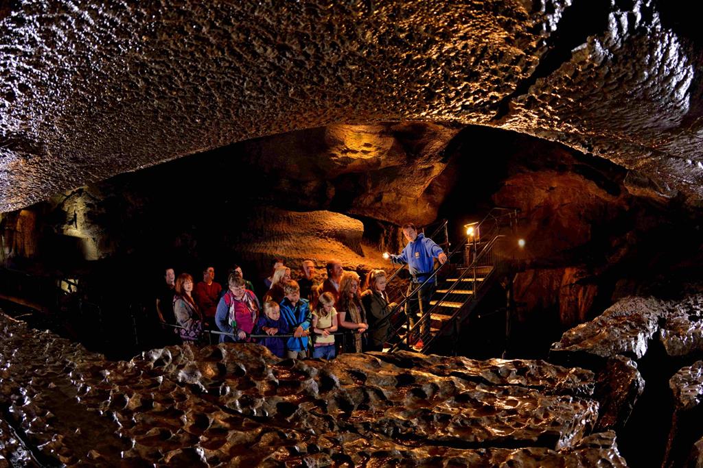
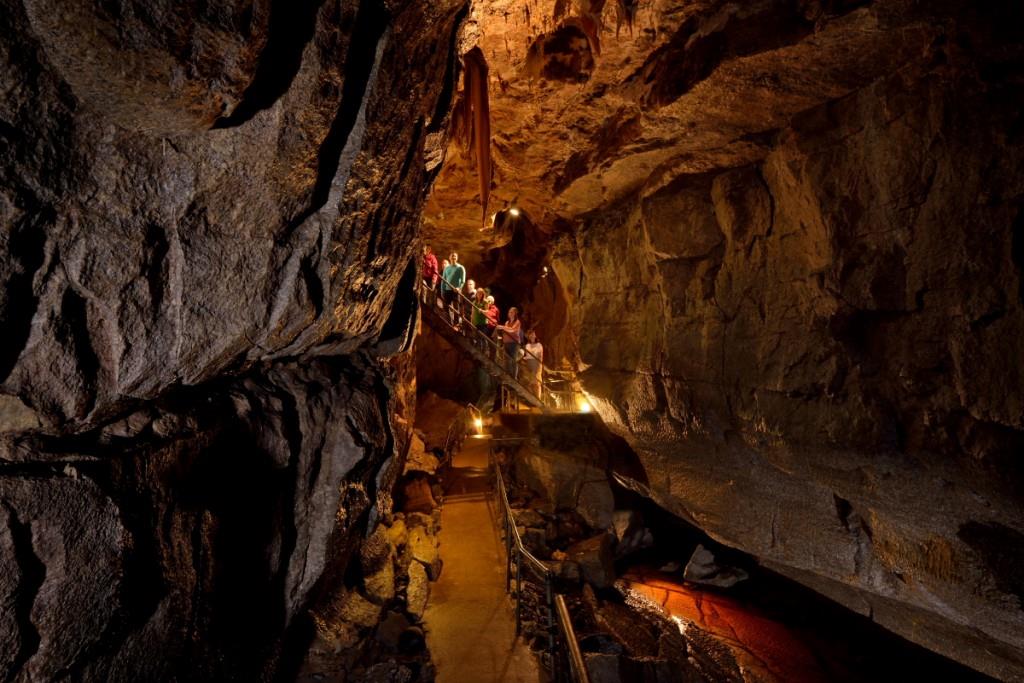
Some 200,000 people visit the Marble Arch Caves UNESCO Global Geopark every year to enjoy the various activities on offer. Some of these include: guided tours of the Marble Arch Caves; hill walking on Cuilcagh Mountain; motor-touring routes of the region; or visiting the majestic viewpoint on top of the Cliffs of Magho overlooking the huge expanse of Lough Erne. Field study programmes attract thousands of schoolchildren, university students and enthusiastic adults who want to learn more about the fantastic natural and cultural heritage in this corner of Ireland.
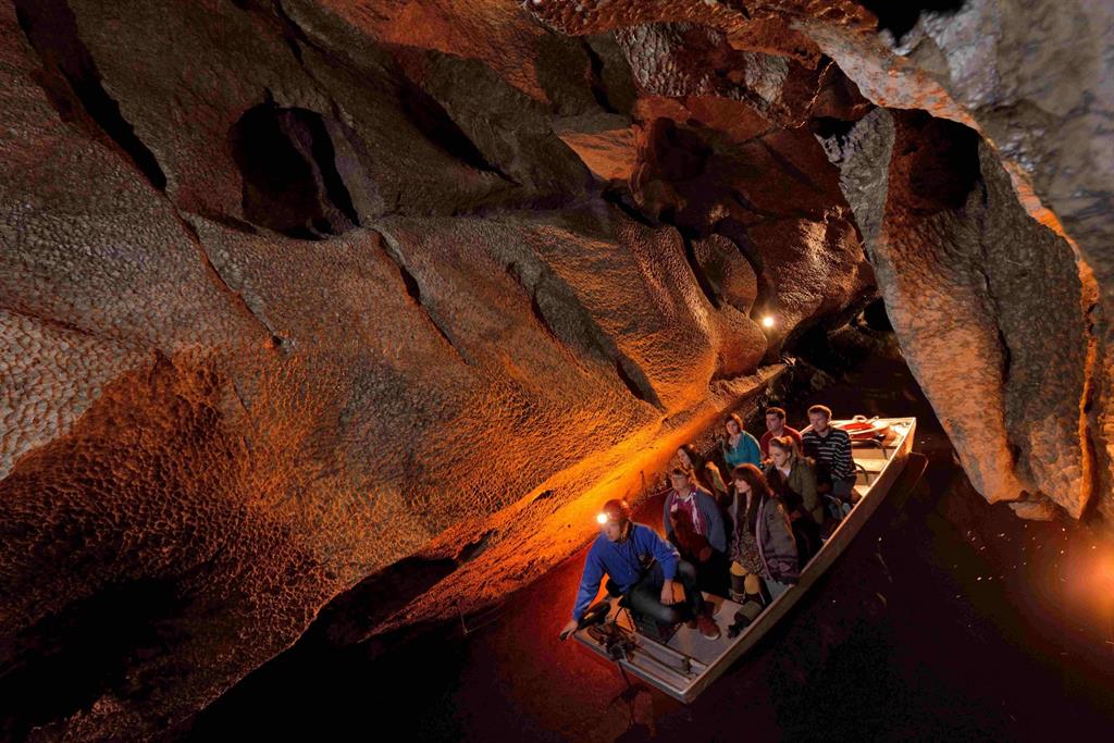
At Marble Arch Caves, guided cave tours allow visitors to explore this magnificent underworld, first by boat past soaring rocky walls along a subterranean river and, later on, walking past bewitching arrays of glistening stalactites, stalagmites and flowstones. Of course, it is not just about geology: the Geopark also contains a particularly high concentration of archaeological features, some dating as far back as Neolithic times. The stunning Burren Forest in west Cavan contains wonderful examples of prehistoric tombs, whilst the turbulent history of Ireland is reflected by the numerous 17th-century castles dotted across the landscape.
Education and sustainable development are core principles of the Marble Arch Caves UNESCO Global Geopark that help to deliver the key objectives of effective management, economic benefits, conservation and environmental awareness. Formal education programmes are available for primary schools, secondary schools and universities. Study subjects include geology, geomorphology, geography, natural habitats, archaeology and tourism. Informal educational events are offered to the general public for all ages including children, families, adults and senior citizens. Sustainable development ensures that the UNESCO Global Geopark supports the regional tourist industry by making the geology, landscapes and natural habitats of the area accessible for the enjoyment of visitors and local people without damaging the environment. The UNESCO Global Geopark contains countryside activity areas where people enjoy outdoor pursuits such as hiking, cycling, caving, water sports and disabled access. Visitor sites include Marble Arch Caves and a variety of geosites, viewpoints, nature reserves, lakes, rivers, churches, castles, prehistoric tombs and other archaeological remains.