The Philippines' first UNESCO Global Geopark, Bohol Island, is part of the Visayas island group. The island's geological identity has been pieced together over 150 million years, as periods of tectonic turbulence have raised the island from the ocean depths.
Celebrating Earth heritage
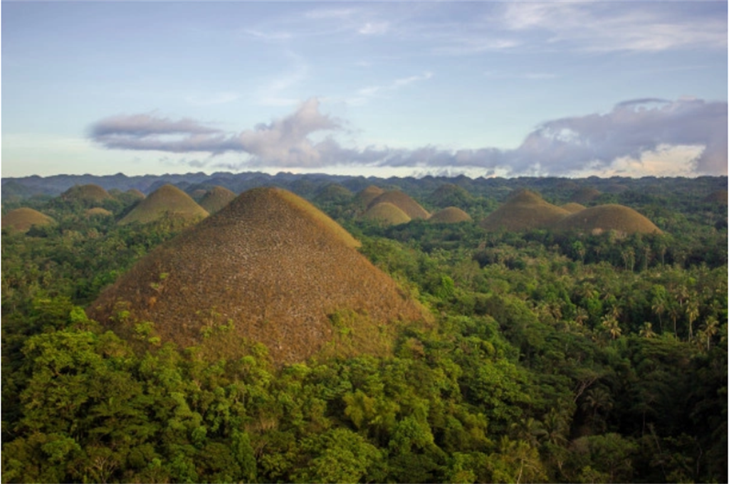
Traces of the island’s subterranean past can be found in the limestone which forms characteristic karstic structures. The geopark abounds in karstic geosites such as caves, sinkholes and cone karst, including the famous cone-shaped Chocolate Hills in the centre of the geopark. The Danajon Double Barrier Reef along the northern coast is the only one of its kind in Southeast Asia and one of just six documented double barrier reefs on Earth; it provides visitors with a chance to discover 6,000 years of coral growth. Danajon Double Barrier Reef consists of two sets of large offshore coral reefs which were formed by a combination of favourable tidal currents and coral growth on a submarine ridge in the area.
Sustaining local communities
The island province is home to 1.4 million inhabitants. The main source of income is agriculture, with rice, coconut, corn crops. Fishery and aquaculture are also important for local livelihoods. Tourism is growing in the area, which is a prime eco-cultural destination thanks to its white sand beaches, diving spots, magnificent geological formations, rich biodiversity, and cultural heritage. Its traditions and culture are proof of how its people adapted to their natural environment.
