Buzău Land is a hilly and mountainous territory covering 1036 km2 , located in the Carpathian Bend Area, in Romania (central coordinate: 45.426060°N, 26.614945°E). It is a completely rural and archaic territory, where ~45,000 people live in 18 mayoralties. There are a total of 169 villages and hamlets, most of them grouped in depressions or strung along valleys, while others are scattered along slopes or on high plateaus. Buzău Land spans an altitude difference of over 1200 m, from ~120 m at its southern border, to over 1360 m in the northern part of the territory. The southern part is characterised by large depressions surrounded by rolling hills. Northwards, the valleys grow deeper and narrower and the rolling hills are replaced by abrupt cliffs, as the landscape grades from hilly to mountainous. The change in landscape is accompanied by a change in vegetation and habitats, with broad-leaved forests gradually replaced by mixed and coniferous forests. The area is characterized by a continental temperate climate, with warm summers and cold winters. Economically, the area relies on subsistence agriculture and animal husbandry. Pasture lands, and fruit tree and berry plantations are the main type of land-use, followed by scarce arable farming and vineyards. More than 55% of the territory is occupied by forests and wild grasslands, not counting pastures. There are no standard industries or commercial centres in Buzău Land, while tourism is an emerging sustainable industry.
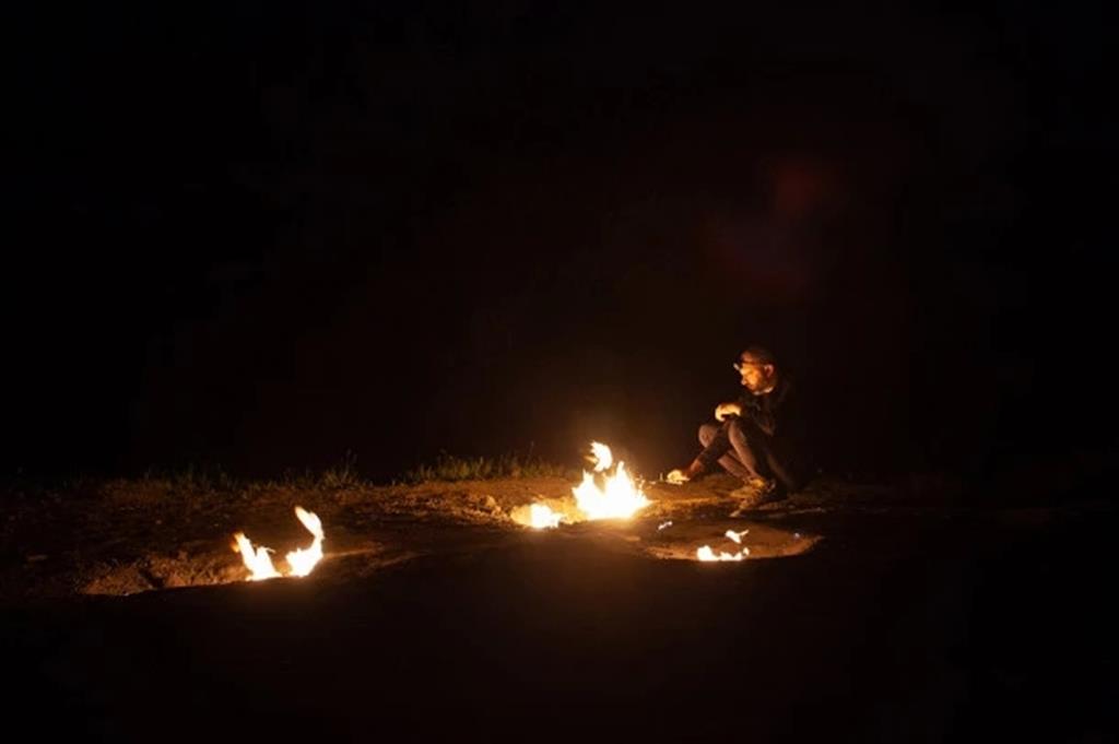
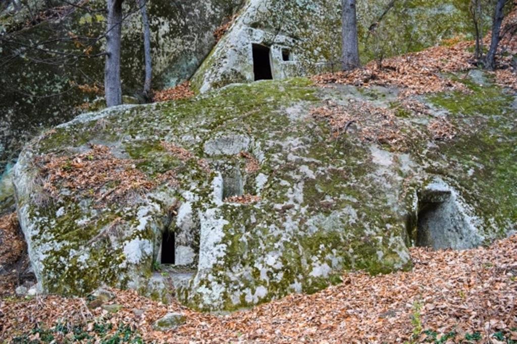
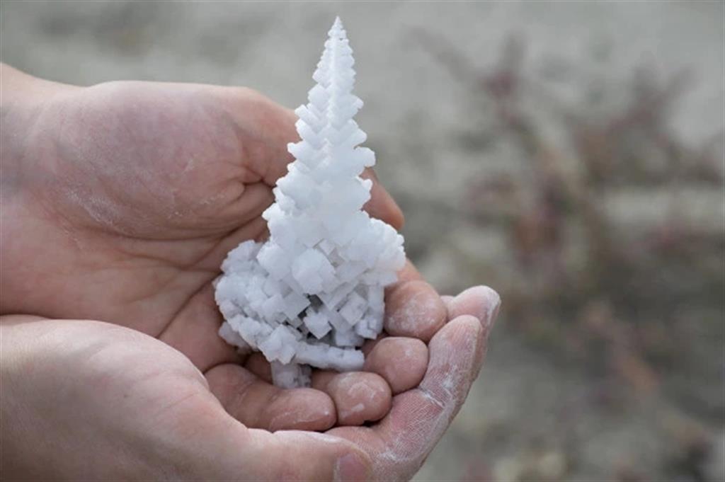
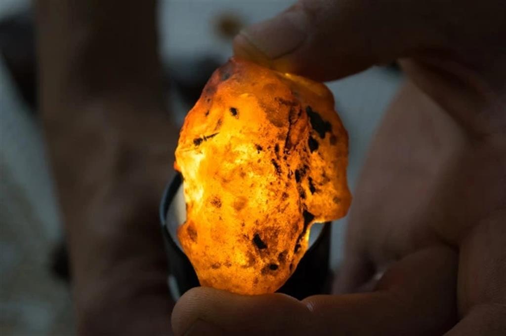
Buzău Land is part of the fold and thrust belt of the Carpathians. It is located near the triple continental junction between the European Megaplate, the Tisia-Dacia and Moesian blocks, in a highly seismogenic area. The territory mostly consists of Eocene to Quaternary rocks, with rare Cretaceous and Jurassic occurrences. The lithology is mostly sedimentary, with occasional pyroclastic units (ash fall deposits) and marks the transition from deep sea (abyssal plain) to terrestrial environment. It records many key moments in the environmental evolution and climate change of the Eastern Paratethys domain, including the Badenian-Sarmatian Extinction Event and the Great Khersonian Drying. It exposes 40 million years of mostly uninterrupted geology and preserves fossils of marine endemic species, terrestrial vegetation, as well as mammals and birds from the last glaciation. Notably, the largest amber deposits in the Carpathians are found here, including an endemic deep-red amber called rumanite. The largest mud volcanoes in Europe are found in Buzău Land, alongside eternal flames, petroleum springs, sandstone concretions and other geological features. Salt domes pierce the surface to develop the most complex karst morphology in Romania. Some of the longest and deepest salt caves in the world are found here. All these occur in a tectonically complex setting overprinted by glacial erosion.
