The geopark is located in the southeast of Northern Ireland, adjacent to the border with the Republic of Ireland, and covers an area of 1,932 km², including a marine area of 294.12 km². People have inhabited this area since just after the end of the last glaciation. It currently has a population of 181,669 (2020) with over a quarter of the population living in the city of Newry in the heart of the geopark.
Celebrating Earth heritage
This geopark tells the tale of how two oceans evolved over 400 million years of geological history. It charts the closure of the Iapetus Ocean and the birth of the North Atlantic Ocean, which generated large amounts of molten rock (or magma) both within the Earth’s crust and on the surface. The subsequent rocks and landscapes have since been shaped by numerous Earth processes but dominated by those during the most recent Ice Age. The last glaciation, at its peak between 27,000 and 23,000 years ago, scoured the landscape, moved rocks and sculpted it into landforms such as drumlins. The combination of mountain and coastal environments has led to the development of a hugely diverse range of glacial features not commonly seen in such a small area. These provide evidence of multiple stages of ice development and movement in the Mourne Mountains and in Strangford Lough.
The region boasts three discrete upland regions in the Dromara Hills, Mourne Mountains, and Slieve Gullion (and the surrounding ring of hills known as the Ring of Gullion).
The highest point in the region is within the Mourne Mountains and is Slieve Donard at 850 metres above sea level. The upland areas are surrounded by sweeping lowlands covered in glacial sediment, much of which is in the form of drumlins. The mountains are dissected by valleys formed by ice during the last glaciation. Carlingford Lough, a drowned glacial valley, lies on the southern edge of the Geopark, and Strangford Lough, the largest sea inlet in the UK and Ireland, lies at the eastern edge of the proposed Geopark, both of which are important to the early human history of the region and later became a major transport routes.
Sustaining local communities
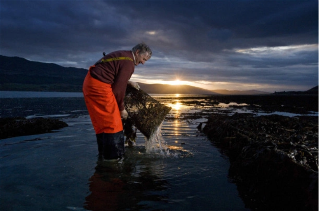
Traditionally, manufacturing, agriculture, fishing and the port of Warrenpoint provided much of the industry, and while they continue to the present, local government is also a source of employment in the region. Agriculture has always been and continues to be an important industry in the Mourne Gullion Strangford UNESCO Global Geopark. All of the lowland areas surrounding the mountains are suitable for agriculture as they are covered in thick glacially deposited sand and gravels which allows for good drainage and therefore good vegetation growth. Traditionally, sheep were farmed in the mountainous area and still are in certain places.
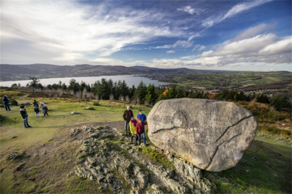
Being a border region between Northern Ireland and the Republic of Ireland, the area suffered during the period of conflict known as ‘The Troubles’ particularly in late 1960s to early 1990s. This meant that economic development was often not as strong as in other parts of Northern Ireland. Some of the best development opportunities lie in tourism, with the area’s natural beauty, unspoiled recreational resources and welcoming people. There is a good-quality regional transport infrastructure and it has the potential to be developed further to encourage rural tourism.
The region participates in the Atlantic CultureScape project, which promotes transnational cooperation among 36 Atlantic regions within six European countries and co-finances projects in the fields of Innovation & Competitiveness, Resource Efficiency, Territorial Risks Management, Biodiversity and Natural & Cultural Assets. The project aims to identify Intangible Cultural Heritage experiences, and to support experience providers with the development of their experiences to boost the tourism offering across this area.
