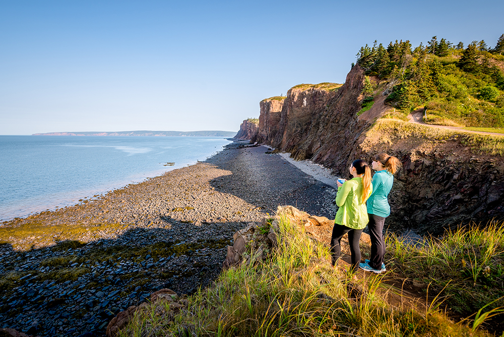
Celebrating Earth Heritage On the North shore of the Minas Basin in Nova Scotia, Canada, the Geopark features a varied landscape of hills, mountains, valleys, heavily forested areas, and coastal marshlands. Its broad biodiversity includes rare birds, fungi and plants. Minas Basin, an inlet in the Bay of Fundy, which is known for having the highest tides on Earth, is part of the Geopark that featu...
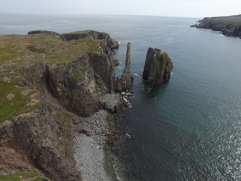
Celebrating Earth Heritage Located in Newfoundland Labrador, in the east of the country, the Geopark covers over 280 km of rugged coastline full of remarkable views on caves, arches and sea stacks. Sites within the boundary of the Geopark bear witness to the region’s geological history which has shaped the land, its human inhabitants and their culture. The area lies entirely with the Avalon terra...
Celebrating Earth HeritagePercé UNESCO Global Geopark is located on the eastern most tip of the Gaspe Peninsula, east of Quebec, in Canada. The Peninsula's climate, greatly influenced by its relief, is generally classified as boreal with cold dry winters (-20°C), but mild summers (over 10°C).The territory of the UNESCO Global Geopark features two distinctly different environment...
Celebrating Earth HeritageThe Stonehammer UNESCO Global Geopark is located on New Brunswick’s Bay of Fundy, at the confluence of the Saint John and Kennebecasis rivers. The UNESCO Global Geopark is bounded on the south by the rugged coastline of the Bay of Fundy; east along the Fundy coast to the Village of St. Martins and the Fundy Trail; northeast to the Village of Norton; west to Little Lepreau...
Celebrating Earth HeritageThe Tumbler Ridge UNESCO Global Geopark comprises a portion of the eastern slopes of the Hart Ranges of the northern Rocky Mountains of British Columbia. High glaciated summits characterise the southern boundary, which is partially the divide between waters flowing northeast into the Murray and Wapiti Rivers, and waters flowing southwest into the Parsnip and Fraser Rivers...