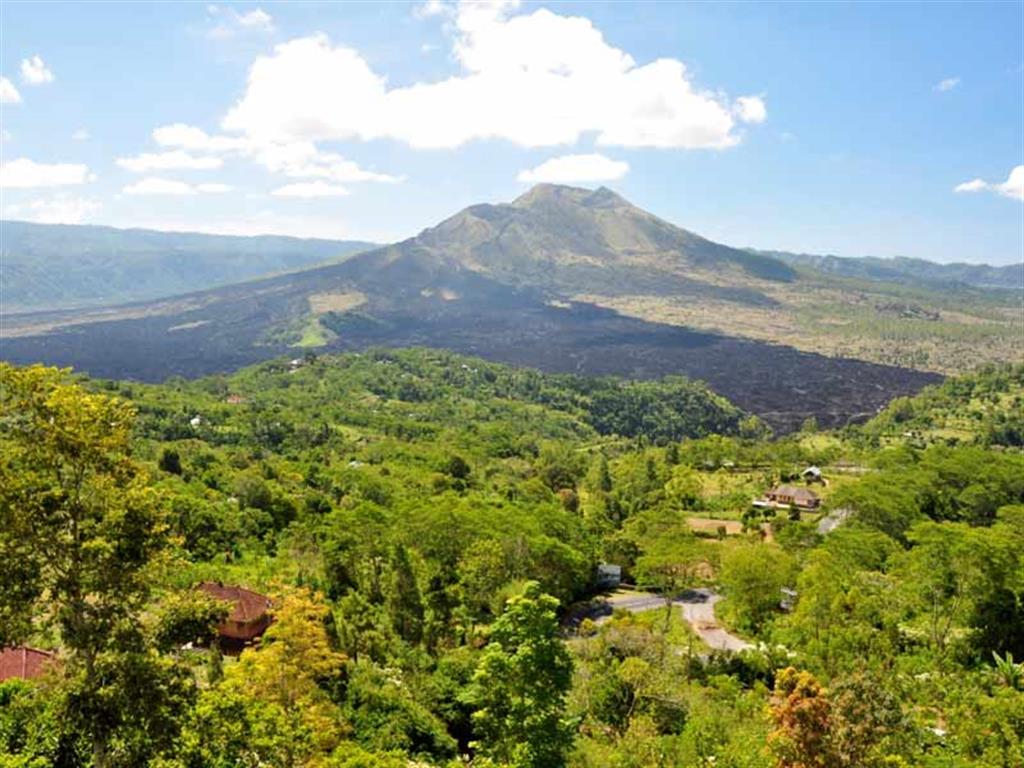


“In the middle of the first caldera emerges Mount Batur volcano, which has a second caldera”
Batur UNESCO Global Geopark is located in northeast Bali, the most popular international tourist destination in Indonesia. It covers an area of 370.5 km2, at an altitude of 920-2152 m a.s.l., the outer-caldera wall surrounds the inner-caldera wall, Mt. Batur and the lake. Most of the Natural Tourist Park of Mt. Batur dan Payang Hill, is a protected forest area included in the UNESCO Global Geopark area.
Batur UNESCO Global Geopark includes two volcanic calderas and presents a complete volcanic landscape with caldera walls, cones and craters, geothermal phenomena (fumaroles, hot springs), a lake, lava flows, pyroclastic flows and tephra. Two cataclysmic eruptions that occurred 29,000 years and 20,000 years ago produced an outer-caldera (old) and inner-caldera (young), respectively, from which the grand landscape scenery originate. Between the years 1804 and 2000, Mt. Batur erupted at least 22 times forming a strato-volcano which is one of 127 active volcanoes in Indonesia, and an important component of the Pacific “ring of fire”. The phenomenon of double-calderas with a crescent-shaped volcanic lake (7 km long, 1.5 km wide) and located 1,031 m a.s.l. was called the finest caldera in the world. The uniqueness of the area’s geology of volcanic origin, endemic flora and fauna, and original culture motivated by the Balinese Hindu religion is a perfect combination of different heritages of the Earth.
The UNESCO Global Geopark is occupied by 15 villages located in the district of Kintamani, Bangli Regency, Bali Province.
The local economy of the UNESCO Global Geopark is mainly based on agriculture and tourism. Kintamani sweet orange and civet coffee are geoproducts of Batur area, in addition to wooden craft, bamboo and wood carving. The Kintamani dog is a local species, native to the island of Bali and originating from Sukawarna Village, Batur.
Through the Batur UNESCO Global Geopark the geosites become the object for conservation, education and growth of local economy through sustainable tourism. The UNESCO Global Geopark developed a program of "School to Geopark" (students explore and recognize nature) and "Geopark to School” (disseminating information about the natural environment of Batur and its Earth’s heritage to schools). Since 2014 students from Singapore choose Batur UNESCO Global Geopark for their annual fieldwork in volcanology science. Batur Volcano Museum, which has developed into a Batur UNESCO Global Geopark Museum, provides educational facilities to visitors. Geology and biology, in combination with cultural components are utilized as a tool for regional development in a sustainable manner.