"The Emerald Karst in the Equator", Raja Ampat UNESCO Global Geopark, is made up of four primary islands, Waigeo, Batanta, Salawati, and Misool. The geopark area's well-preserved, unique, and scarce landscapes captivate visitors and entice them to delve deeper into the aesthetic value it offers. The geopark's geological structures, such as joints and faults that facilitate e...

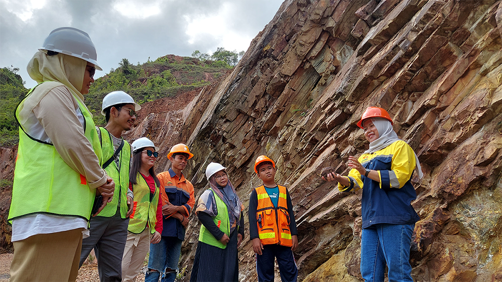
Situated in the central part of Sumatra Island, the Merangin Jambi UNESCO Global Geopark comprises 12 out of the 24 sub-districts within the Merangin Regency, which forms part of Jambi Province, Indonesia. The region's topography encompasses lowlands on the eastern side and highlands on the western side, with the highest peak reaching an elevation of 2,900m above sea level on Mount Masura...
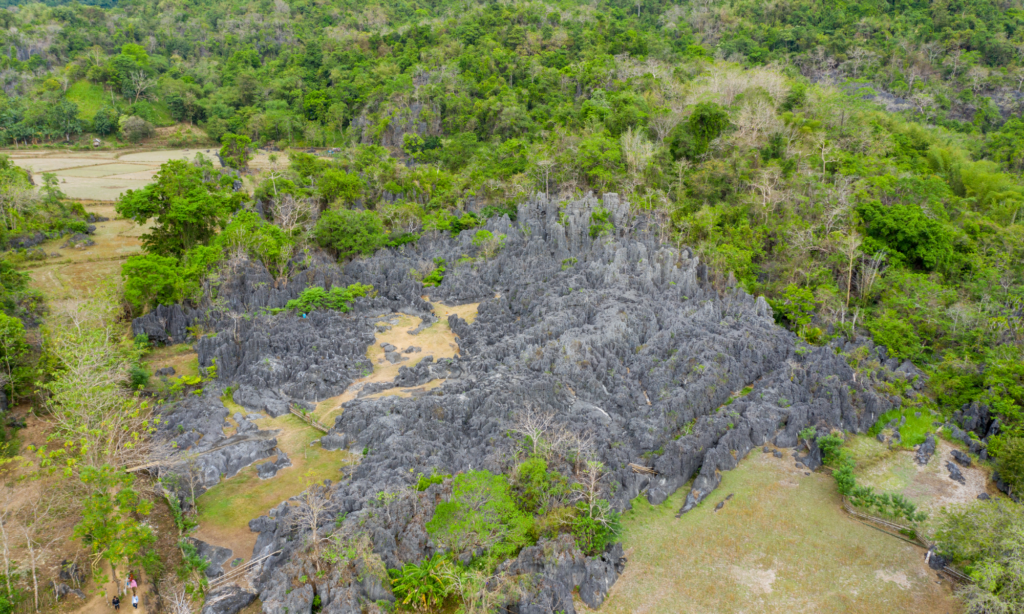
Maros Pangkep UNESCO Global Geopark is located in the southern part of Sulawesi Island, intersected by the Wallace Line and encompasses Maros and Pangkep Regencies in South Sulawesi Province. The geopark land accounts for 44.6% and water covers 55.4% of the total area, primarily consists of the Bantimurung Bulusaraung National Park on the mainland, along with the Kapoposang Water Tourism Park...
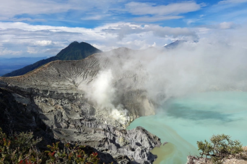
Ijen UNESCO Global Geopark, located in East Java, Indonesia, boasts with natural wonders and renowned for its volcanic landscape, unique geological formations, and cultural heritage. It encompasses Mount Ijen, a stratovolcano with a picturesque turquoise crater lake known as Kawah Ijen, which is the most acidic lake in the world, as well as the Belambangan Biosphere Reserve, designated by UNE...
Celebrating Earth HeritageBatur UNESCO Global Geopark is located in northeast Bali, the most popular international tourist destination in Indonesia. It covers an area of 370.5 km2, at an altitude of 920-2152 m a.s.l., the outer-caldera wall surrounds the inner-caldera wall, Mt. Batur and the lake. Most of the Natural Tourist Park of Mt. Batur dan Payang Hill, is a protected forest area included in...
Celebrating Earth HeritageBelitong Geopark is apart of Bangka Belitung province, located about 400 km north of Jakarta, the capital of Indonesia, and surrounded by the Karimata Strait to the north, the Java region to the east and south, and the Gaspar Strait to the west. Its geographical boundaries are 107°13'00"-108°51'00 "east longitude and 02°29'30"-03&...
Celebrating Earth Heritage Ciletuh - Palabuhanratu UNESCO Global Geopark is located on the island of Java, in the western Sukabumi Regency of Indonesia. The Geopark is located on the border of a tectonically active zone: the subduction zone between the Eurasian plate and the Indo-Australian plate, which continue to converge at 4 mm/year. The area is characterized by a rare geological diversity ...
Celebrating Earth HeritageLocated in the Southern Mountains of East Java, Gunung Sewu UNESCO Global Geopark extends east-west along 120 kilometres. A depression zone occupied by Merapi and Lawu active volcanoes limits its northern part, while the south is bordered by the Indian Ocean. The area, at an altitude between 5 m and 700 m asl, has mountain ranges of Upper Paleogene rocks and thousands of ...
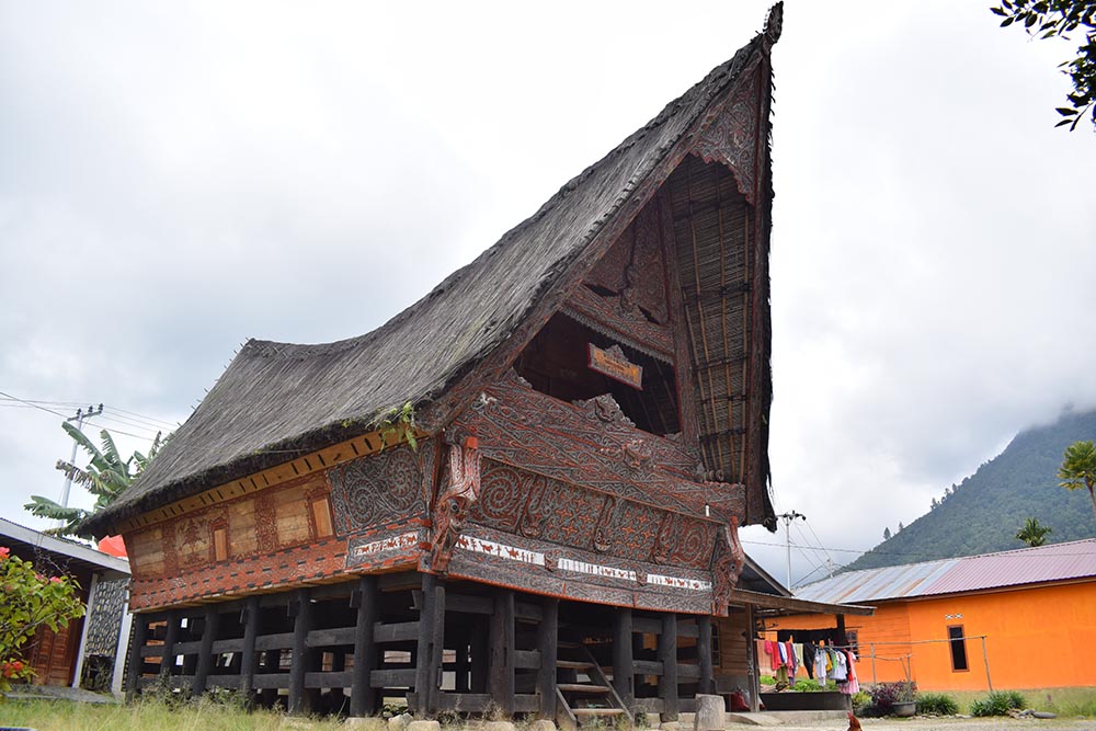
Celebrating Earth HeritageLake Toba is situated in Sumatera island (Indonesia), formed by amega-volcanic eruptions 74,000 years ago, is the largest with-in the Quaternary (since +2 Ma). It is the ‘super-volcano’ eruption (VEI> 8) which produced 2,800 km3 pyroclastics materials, where 2,000 km3 of volcanic-ash dispersed to W-NW, and also distributes of sulfuric-acid aerosol to the atmosphere whi...
Celebrating Earth Heritage Rinjani-Lombok UNESCO Global Geopark is situated on the island of Lombok in Southeast Asia. As part of the Lesser Sunda Islands or Kepulauan Nusa Tenggara, the island is located between Bali and the Lombok Strait to the west and Sumbawa and the Alas Strait to the east. Rinjani-Lombok UNESCO Global Geopark has a rich and diverse landscape, forest types ranging from sav...