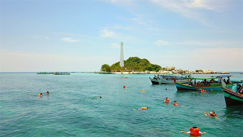

“Island hopping to explore the TOR Granite Landscape in sea environment ”
Belitong Geopark is a part of Bangka Belitung province, located about 400 km north of Jakarta, the capital of Indonesia, and surrounded by the Karimata Strait to the north, the Java region to the east and south, and the Gaspar Strait to the west. Its geographical boundaries are 107°13'00"-108°51'00 "east longitude and 02°29'30"-03°25'00 "south latitude. Belitong Geopark has a total area of about 4,800 square kilometers of land and 13,000 square kilometers of sea and is surrounded by 241 small islands, including the islands of Mendanau, Kalimambang, Gresik and Selu. Belitong Geopark has a tropical climate and consists of several geological diversities. The main land consists of the combination of flooded hills surrounded by lowlands reaching the level of 0 abova (masl). The upland cluster region exists at its highest point, up to 510 masl in the center of the country. This highland region is composed of sedimentary rocks that are part of the Tajam formation. The highest point is at 415 masl, which is the Burung Mandicule cluster, which includes Mang and Malang. The other hill clusters range from 300 to 400 masl in the northwest and east of the center of the country. The northwestern hill clusters are composed of the oldest Belitung plutonium, the Tanjungpandan granite, while the east-central clusters are generally composed of metasedimentary rocks as part of the Kelapakampit formation. The southwestern hill clusters range from 50 to 300 million in elevation and are composed of the Jurasic plutonic rock, adamelite, which is part of the Ademalite Baginde Rocks. As of 2018, the population of Belitung Island is about 288,771. The highest density is in Tanjungpandans sub-district with 55.73% and the lowest in Selat Nasiks sub-district with 3.57%. Six religions are present on the island, including Islam, Buddhism, Christianity, Catholicism, Hinduism and Confucianism. Most of the land is rural and the majority of the population is engaged in agriculture, including white bell pepper, coconut and oil palm. Fishing is considered an important sector, as many villages are located in the coastal area. However, tin mining has contributed to the local economy for many years.
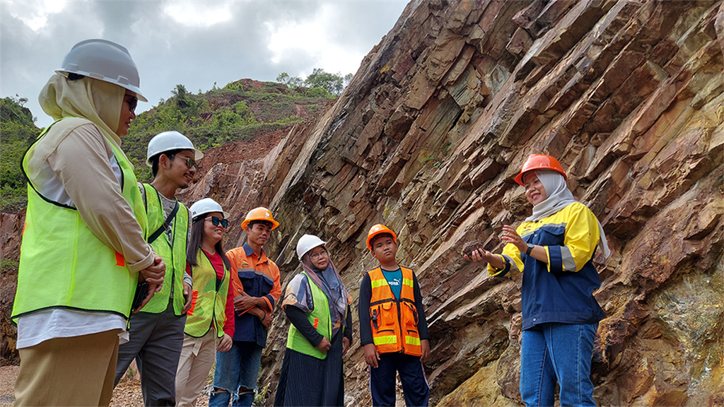
The world-class geological heritage of Belitong Geopark is the TOR granite landscape. The formation of the TOR granite is characterized by the presence of massive granite that has a low proportion of joints on the surface. The morphological parameter of the TOR granite is associated with the marine environment, which may reflect the occurrence of intrusions when the Belitung Island is at this level. This formation can be found in the northwestern part of Belitung Island throughout the coastal plains. These groups of rocks of TOR graniter form the small islets which can be visited by boat. These rocks can show the excellent sampling of rocks to attract the visitors to capture the image. These important geological features of NamSalu primary tin deposit in Kelapa camp can be identified from the parameters of the mineral structure. The deposit has been recognized as the most important deposit in the Southeast Asian region. The information can explain the economic mineral occurrences. This site offers opportunities for underground adventure, education, history and culture to attract tourists. The open ramp can be used for educational purposes, and visitors can see the exposed rocks that represent the oldest rock on Belitung Island. These rocks can show the evolution of the ancient phenomenon which can be followed from the fossils, mineral contents, rock properties and other important elements. Teckstites are very rare elements that can be recognized as a heritage of international geological importance. They were discovered on Belitung Island, which is part of the Australian Scrub Field, and are distributed in about 18-19% of the world (Mccall, 2005).
