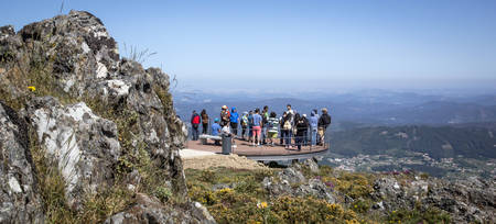
“Motherland of the biggest trilobites in the world”
The Arouca UNESCO Global Geopark is located in northern Portugal and coincides with the area of the Arouca Municipality. This territory is located on the western border of the north sub-plateau of the Iberian Peninsula, and is characterized by mountains carved by narrow valleys. The average altitudes range from 200 to 600 m but exceeds 1000 m in Freita (1100 m) and Montemuro (1222 m) mountains.
The Arouca UNESCO Global Geopark is renowned for its exceptional geological heritage of international significance, with 41 geosites. Rocks that outcrop in this region tell stories of the ancient seas that bordered the supercontinent Gondwana 520 to 420 million year (Ma) ago and chronicle the formation of the next supercontinent called Pangea that formed 250 Ma ago. The Arouca UNESCO Global Geopark territory is framed in the major morphostructural unit of the Iberian Peninsula – the Hesperian Massif, which is the largest fragment of the Variscan basement that crops out in Europe. In the Arouca UNESCO Global Geopark are three main lithological groups: i) the basement, formed by metasedimentary rocks with Neoproterozoic to middle Cambrian in age (630-520 My); ii) the Paleozoic sequence, represented by the Ordovician, Silurian and Carboniferous rocks; and iii) the magmatic bodies represented by the sin-orogenic granitoids differentiated into six main plutonic bodies. Besides the diversity of the Variscan magmatic rocks, some other important late variscan dyke rocks are known partly linked to relevant mineralizations that gave mining recognition to this region. One of the most distinctive characters of the Geopark's geodiversity is due to the high fossil content of the Ordovician slates (460-470 Ma ago), with giant trilobites up to 90 cm in size, the Giant Trilobites of Canelas, together with a specific granitic body that contains a remarkable abundance of nodules ranging from 1−12 cm in diameter, the Birthing Stones of Castanheira. A popular legend attributes magical properties to these nodules in terms of female fertility, since these dark mineral lumps pop out spontaneously from a creamy-coloured matrix due to differential dilatation during hot weather.
Arouca UNESCO Global Geopark has a population living of 22.359 inhabitants. The use of the territory covers 0.4 % industrial area, 5.4 % urban area, 43 % National Ecological Reserve and 7.1 % National Agricultural Reserve. About 47 % of the territory belongs to Natura 2000 network of protected areas.
This area also has a national archeological, historical, cultural and mining relevant legacy, such as Neolithic graves, Roman and Medieval ruins, the Arouca Monastery and the abandoned tungsten mines of Regoufe and Rio de Frades.
The Arouca UNESCO Global Geopark has been implementing actions towards territorial sustainability, taking into consideration its natural and cultural heritage, promoting science knowledge and encouraging behaviour changes. During the year the Arouca UNESCO Global Geopark Association promotes and carries out dozens of activities and initiatives to showcase the dynamics of this territory. Among them must be emphasized the educational programs focused on the different realities of the territory and which every year attract thousands of students and teachers for new challenges of learning and discovery activities.
The Educational Programs and Educational Projects of the UNESCO Global Geopark involve as much as possible the educational community and are based on a set of field trips along the territory mostly focused on the regional geological heritage. These Educational Projects include school contests, educational exhibitions, geological story books, pedagogical games and training courses for teachers and local guides. Other educational projects, like “Geoinvolve Project” and “Communitarian Tourism Project”, promote the development of new skills in the local communities, and the excellence of this territory, certified also with the European Charter for Sustainable Development.
This area is also famous for Geotourism activities, especially for adventure sports such as rafting, canoeing, canyoning, rock climbing and the network of walking trails. It allows the visitors to discover the majority of the geosites, enjoy breathtaking landscapes, meet people and experience local traditions. They can also taste the famous local cuisine, based in the indigenous cattle breed and the convent pastries, with traditions dating back to the foundation of the Monastery of Arouca in the 10th century.


